
Tornados
California may not be a tornado hot spot, but on occasion, we too can get some pretty exciting weather on occasion!
September 29, 2019: Tornado?
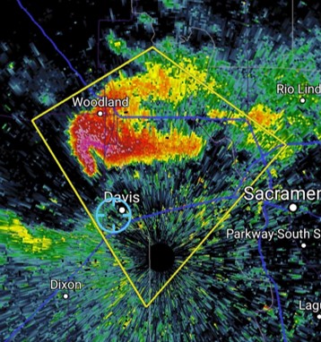
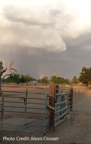
Thanks to undergraduate student Ameya Naik for the radar reflectivity image taken at 6:09 PM and to undergraduate student Alexis Clouser for this picture of the supercell around 6:40 PM.
February 21, 2005: Funnel Cloud North East of Davis
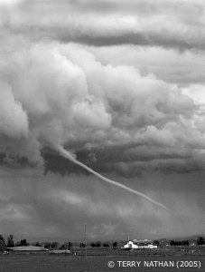
Funnel cloud photographed from East
Davis on February 21, 2005.
On February 21, 2005 the National Weather Service issued a severe thunderstorm warning for the greater Sacramento region, including Sutter and Yolo counties. At about 2:00 p.m. local time this funnel cloud, which developed a few miles North East of Davis, was photographed by Terry Nathan and captured on video by Kyaw Tha Paw U, two faculty members of the UC Davis Atmospheric Science Program. The photograph was taken from the Mace Boulevard-Interstate 80 overpass in East Davis and the view is looking to the northeast.
According to the warning, a severe thunderstorm capable of producing a tornado moved north through the area at 20 mph. Several funnel clouds were spotted and two tornadoes were confirmed to have touched down near Sacramento. In contrast to their Midwestern counterparts, California tornadoes are weaker and less frequent, have shorter path widths and lengths, and occur mostly during the cool (winter) season.